


From the US National Weather Service
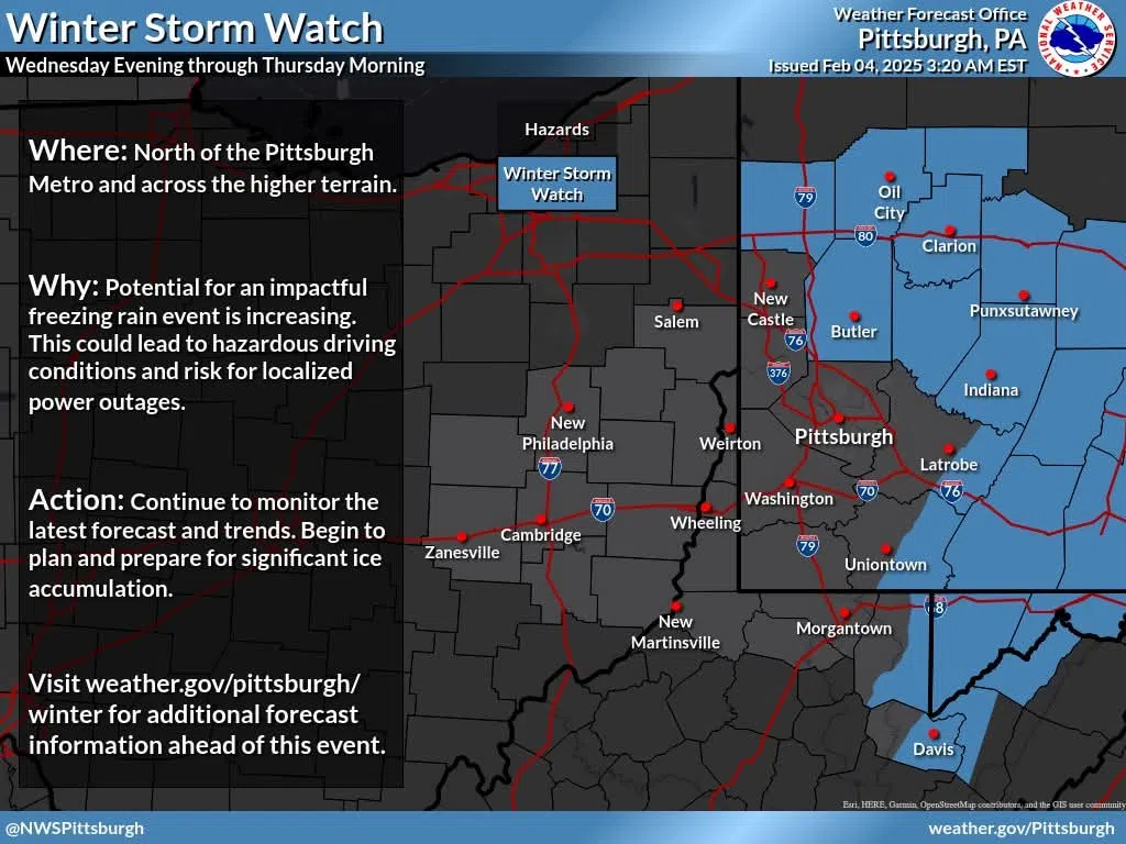
⚠️Winter Storm Watch Expanded…
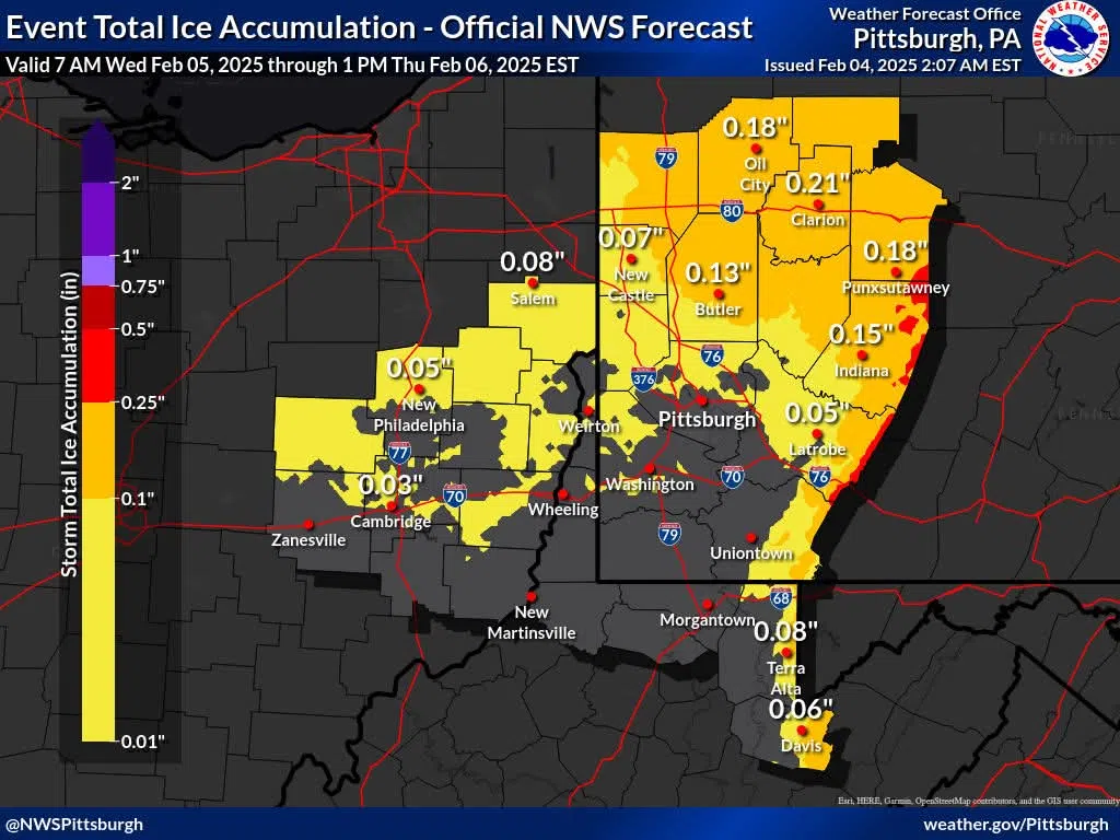
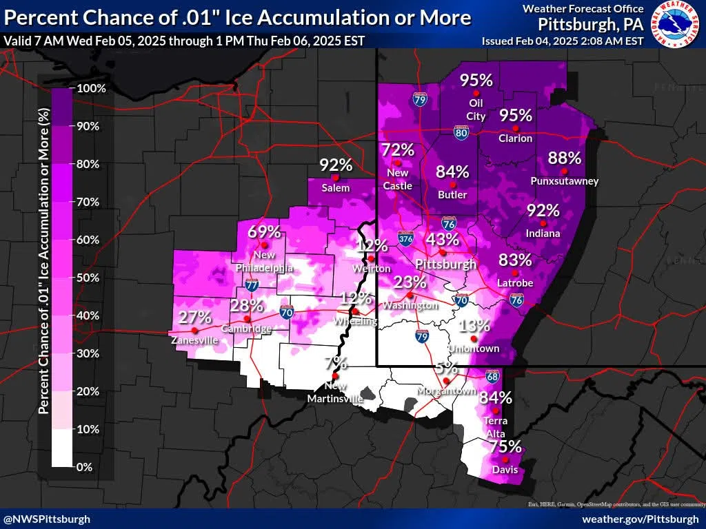
Confidence in a period of freezing rain late Wednesday night and early Thursday morning continues to grow. These images below show the expected ice amounts across the area, the probability of seeing at least a glaze of ice, and the Winter Storm Watch area.
You’ll notice higher amounts and probabilities are focused along the Laurels and Allegheny Mountains, and north of Pittsburgh along the I-80 corridor. This area of highest probability is included in a Winter Storm Watch for freezing rain Wednesday night into Thursday morning.
Remember, a Watch is our first official “heads up” that there is increasing confidence for Winter Storm Warning criteria snow (6+ inches) or ice (1/4 inch or more). Areas outside of the current Watch will likely still need a Winter Weather Advisory when Watch areas are upgraded to a Warning in the next couple of days.
Brief Synopsis:
Light snow will move into the area on Wednesday ahead of a warm front. Rain will then move in from the south Wednesday evening and overnight as air aloft warms but surface temperatures remain below freezing. This will lead to a period of freezing rain, which will last longest in the higher terrain and north of Pittsburgh. As temperatures continue to warm early Thursday, freezing rain will transition to plain cold rain.


Comments