


From the US National Weather Service
As temperatures warm through today, snow chances -> ice chances -> rain chances from southwest to northeast. Snow will remain little to none for most, but freezing rain may accumulate. The highest probability of impactful ice lies in the high terrain east of Pittsburgh and areas north of I-80.
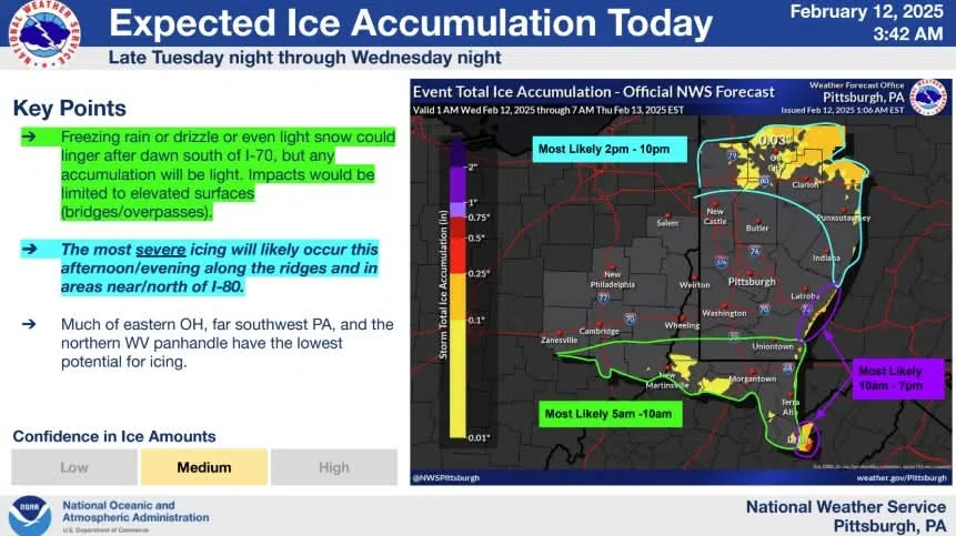
NWS expected ice forecast on a map with timing highlighted.
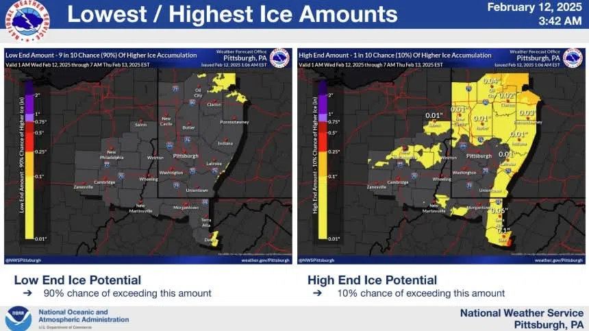
NWS low end and high end ice potential on a map

NWS chances of exceeding 0.01″ and 0.1″ of ice on a map


Comments