


From the US National Weather Service
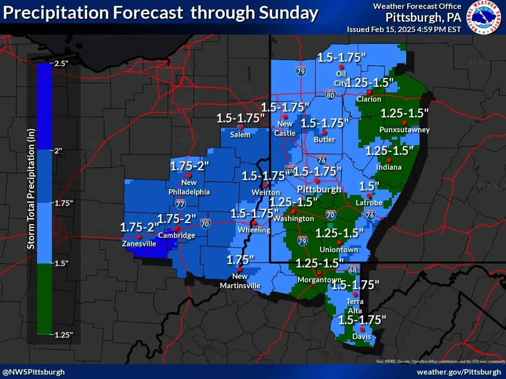
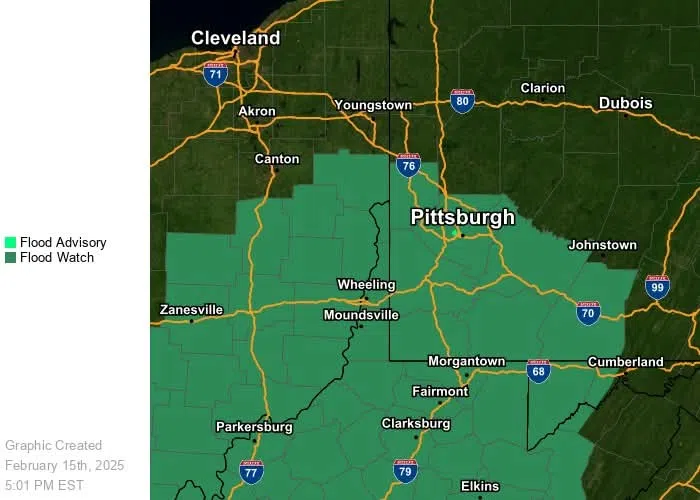
The snow and freezing rain has finally changed to all rain across the entire area and a large chunk of the rain has ended. Now we wait for the next swath that will switch the focus to potential flooding. We expect the next batch of rain to begin to overspread the area this evening from the southwest and the rain will continue into Sunday morning. Current data is pointing to the axis of heaviest rain being just west of Pittsburgh across Ohio and possibly clipping counties to the north of Pittsburgh along the Ohio border. We are continuing the flood watches into Sunday. Temperatures will slowly rise through the evening and overnight.


Comments