From the US National Weather Service
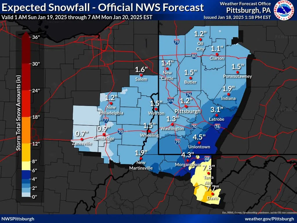
We continue to watch the evolution of expected snow totals Sunday into Monday. Here are two images that give different forecast perspectives. The first image is our “most likely” snowfall forecast. If you need one number, this “deterministic” forecast is the one to use.
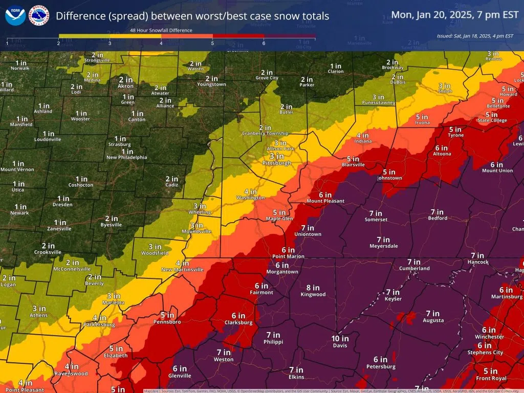
However, there remains a great deal of uncertainty with these totals, particularly southeast of Pittsburgh, due to the variance in storm track among the models. The second image shows the potential “spread” in snowfall totals in the National Blend of Models – the difference between the worst case and best case scenarios. Note how the spread increases to 6 inches closer to high elevation areas – with differences of 10 inches in Tucker County! Basically: the higher the spread, the higher the level of uncertainty. This is the type of “probabilistic” forecast information that you will see more and more of from us!
All that said, these spread totals have shown a slight downward trend today – indicating slightly better confidence in the snowfall forecast. We will continue to monitor all of the possibilities and update the forecast as necessary.


Comments